Arizona White Mountain Hiking
Best Hiking and Trails In And Around The Arizona White Mountains
Discover Arizona's best White Mountain hiking trails.
Follow the streams and rivers, ascend a mountain slope, traverse the many flower laden valleys. The Arizona White Mountains have them all!
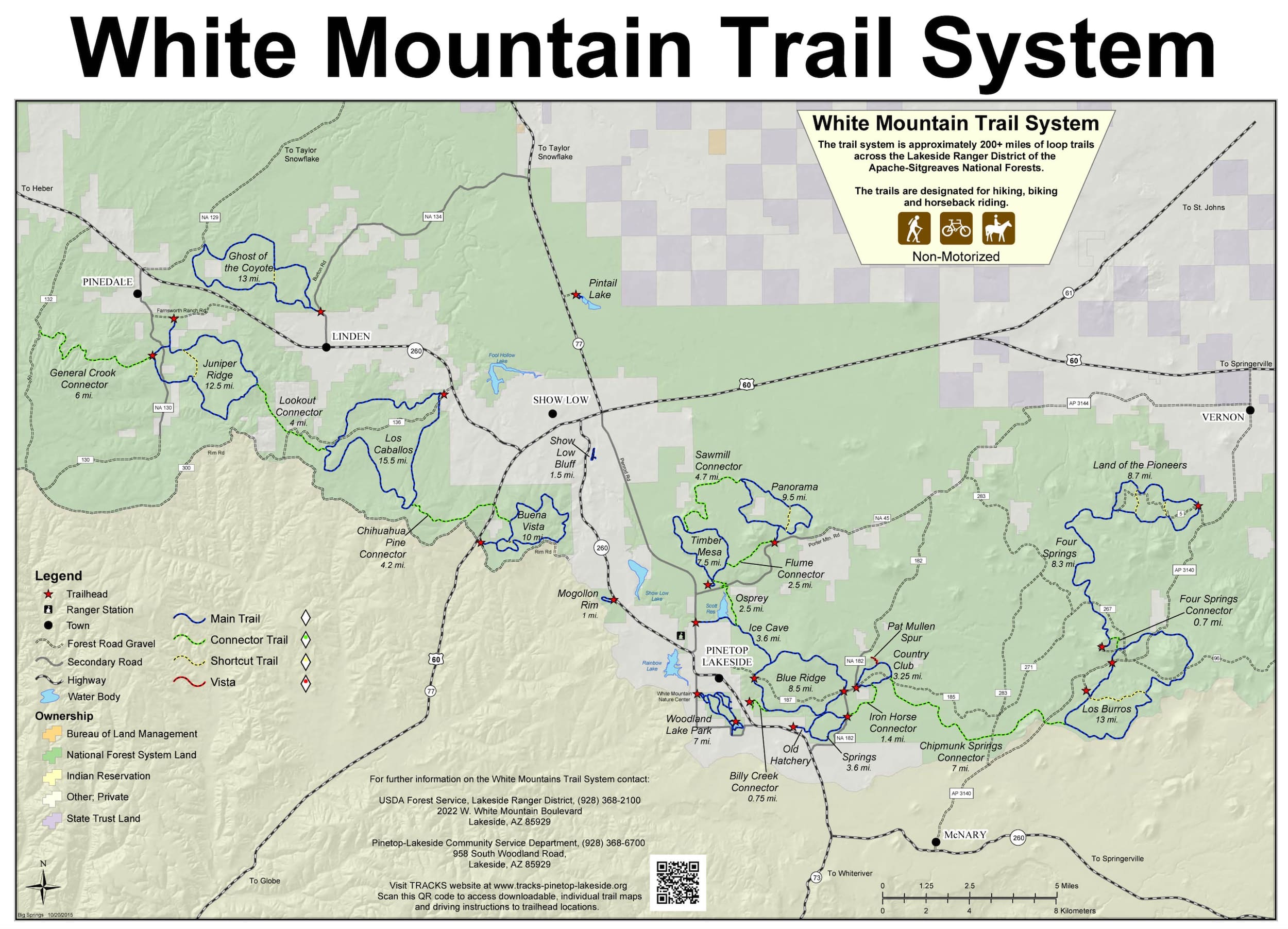
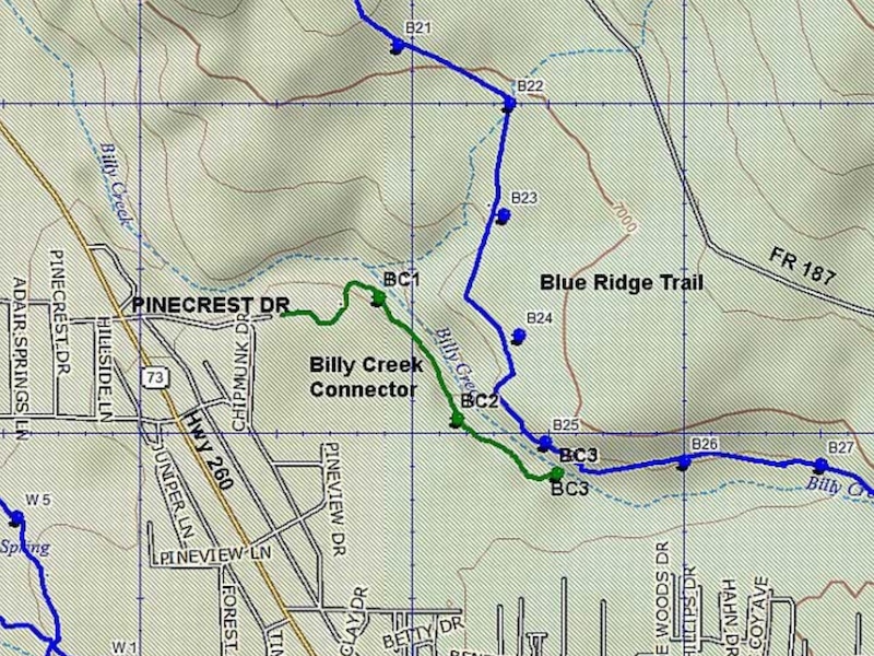
Billy Creek Connector #107A
The trail winds along Billy Creek for about a quarter of a mile and connects with the Blue Ridge Trail at its Southeast corner.
White Mountain author Jonathan Austen explores the Billy Creek Connector #107A
Distance: 0.75 miles
Rating: Easy
Hiking - Mountain Biking - Equestrian
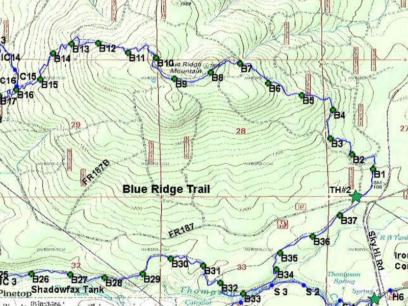
Blue Ridge Trail #107
Follows Billy Creek through a Ponderosa pine forest to the top of Blue Ridge Mountain, with scenic vistas.
Distance: 9.4 miles
Rating: Moderate to Difficult
Hiking - Mountain Biking - Equestrian
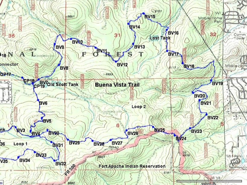
Buena Vista Trail #637
Follows portions of old logging roads through oak, Manzanita, and pine. Impressive views are available on a clear day.
Distance: 10 mile loop
Rating: Moderate to Difficult
Hiking - Mountain Biking - Equestrian
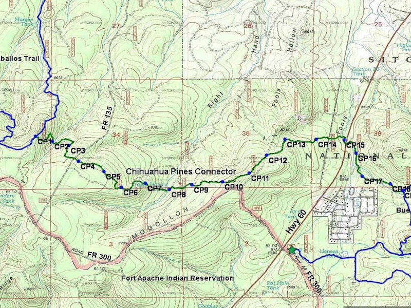
Chihuahua Pine Connector #638A
Many short, steep climbs. The rocky terrain makes mountain biking technical. The trail is named for the Chihuahua pine.
Distance: 4.2 miles
Rating: Difficult
Hiking - Mountain Biking - Equestrian
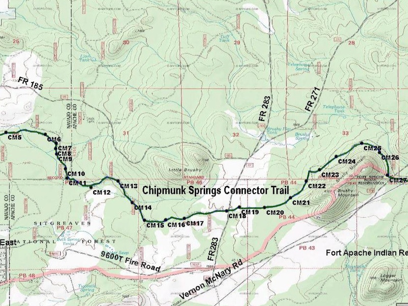
Chipmunk Connector #631A
See Download below for details and directions
White Mountain author/photogrpher Jonathan Austen explores the Chipmunk Connector #631A
Distance: 7.5 miles
Rating: Moderate
Hiking - Mountain Biking - Equestrian
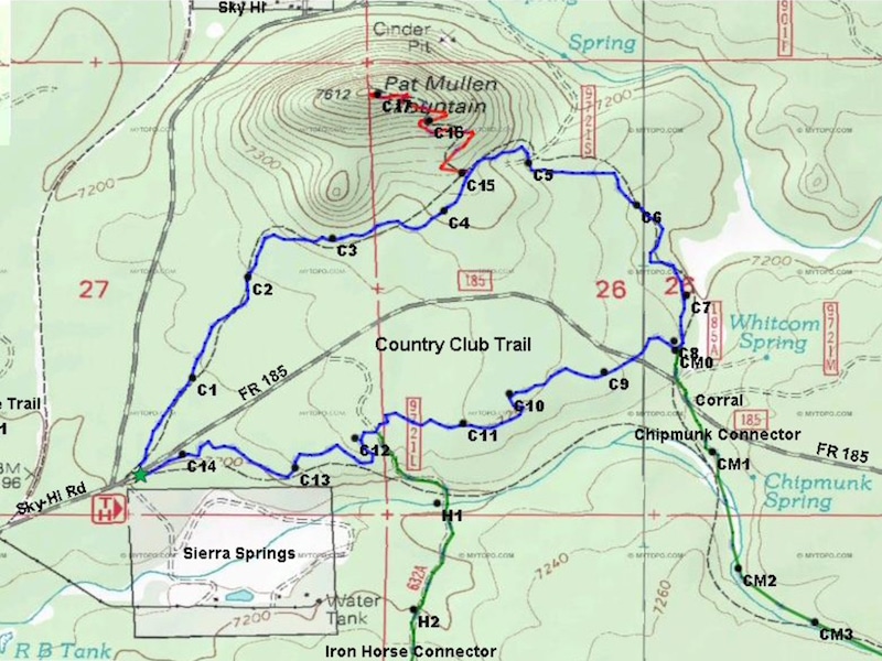
Country Club Trail #632
Loops through a Ponderosa Pine forest along Whitcomb Springs Meadow. It follows portions of the old railroad bed.
White Mountain author Jonathan Austen explores the Country Club Trail #632.
Distance: 3.25
Rating: Easy to Moderate
Hiking - Mountain Biking - Equestrian
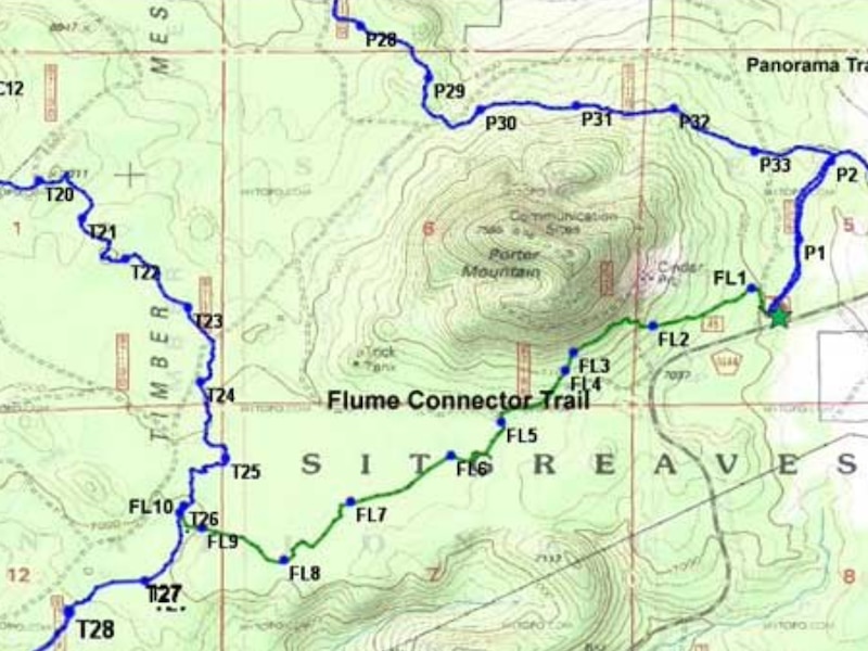
Flume Connector #636B
Named for the flume which carries irrigation water. Visible on the south side of FR 45, just east of the Timber Mesa Trailhead turnoff.
White Mountain author Jonathan Austen explores the Flume Connector #636B trail here.
Distance: 2.5 miles
Rating: Moderate
Hiking - Mountain Biking - Equestrian
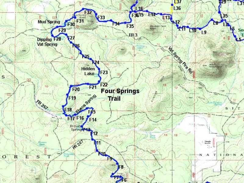
Four Springs Trail #652
The trail winds between four springs and Hidden Lake. Site of a historic sheep camp. Portions of this trail are extremely steep.
Distance: 8.3 miles
Rating: Difficult
Hiking - Mountain Biking - Equestrian
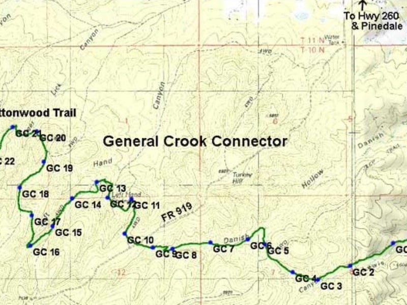
General Crook Connector #104A
Hike through some of the area burned out by the Rodeo-Chediski Fire of 2002, providing fabulous views and prolific wild flowers.
Distance: 6 miles
Rating: Moderate to Difficult
Hiking - Mountain Biking - Equestrian
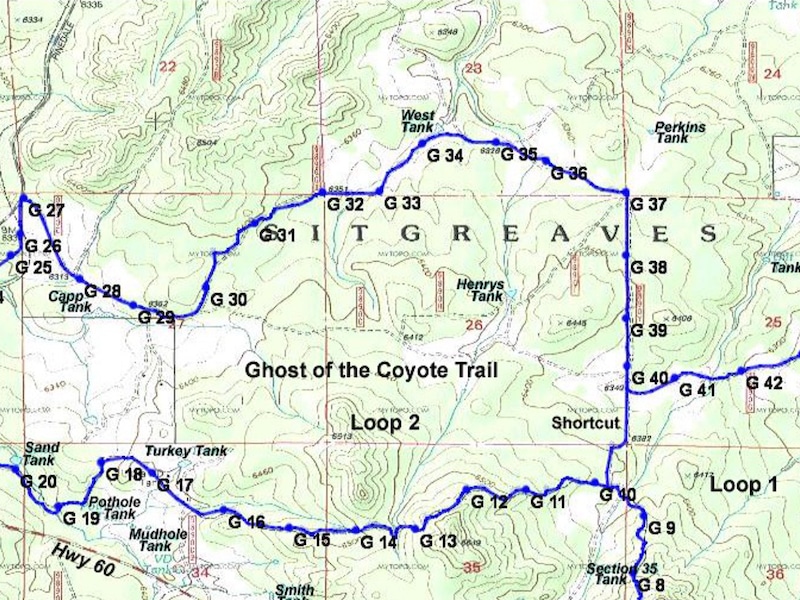
Ghost Of The Coyote #641
Old logging roads through pinion juniper forest. Vistas offer panoramic views of the White Mountains, including Mount Baldy.
Distance: 13 miles
Rating: Difficult
Hiking - Mountain Biking - Equestrian
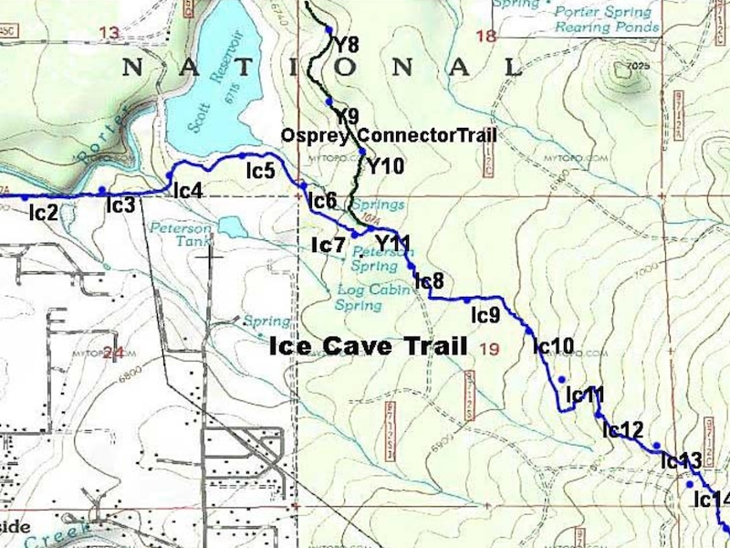
Ice Cave Trail #608
Midway along the trail is the "Ice Cave", a lava tube. Named for the constant flow of cool air leaving the cave.
Distance: 3.6 miles
Rating: Moderate to Difficult
Hiking - Mountain Biking - Equestrian
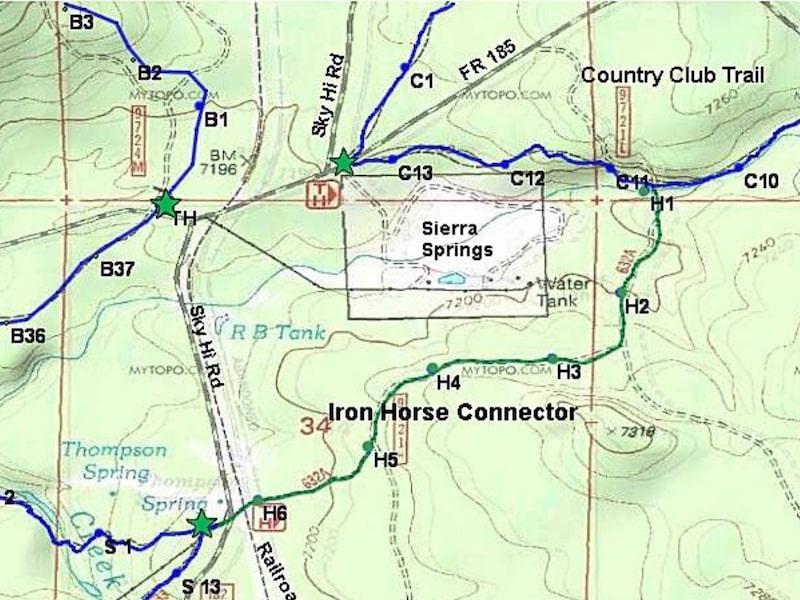
Iron Horse Connector #632A
Trail is fairly flat but somewhat rocky. The trail crosses the abandoned Apache railroad bed.
Distance: 1.4 miles
Rating: Easy
Hiking - Mountain Biking - Equestrian
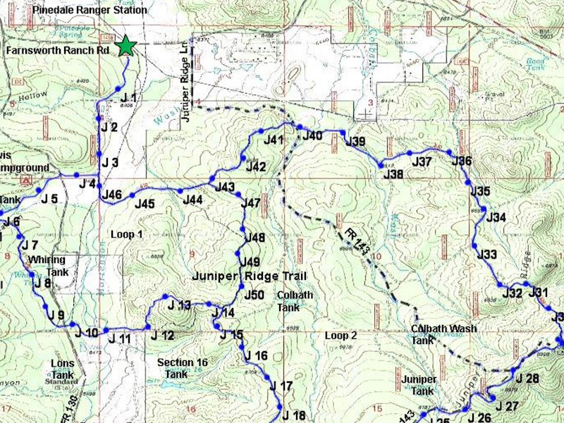
Juniper Ridge Trail #640
Trail goes past the Lookout Tower and some of the burned area. Interesting views of ecological changes caused by the fire.
Distance: 12.44 miles
Rating: Moderate to Difficult
Hiking - Mountain Biking - Equestrian
*Land Of The Pioneers #651
Box canyon and ruins of a pioneer cabin onto in the North leg of the loop are must sees. Includes two shortcut loop rails.
Distance: 3.5, 6.8, & 8.7 mile loops
Rating: Moderate to Difficult
Hiking - Mountain Biking - Equestrian
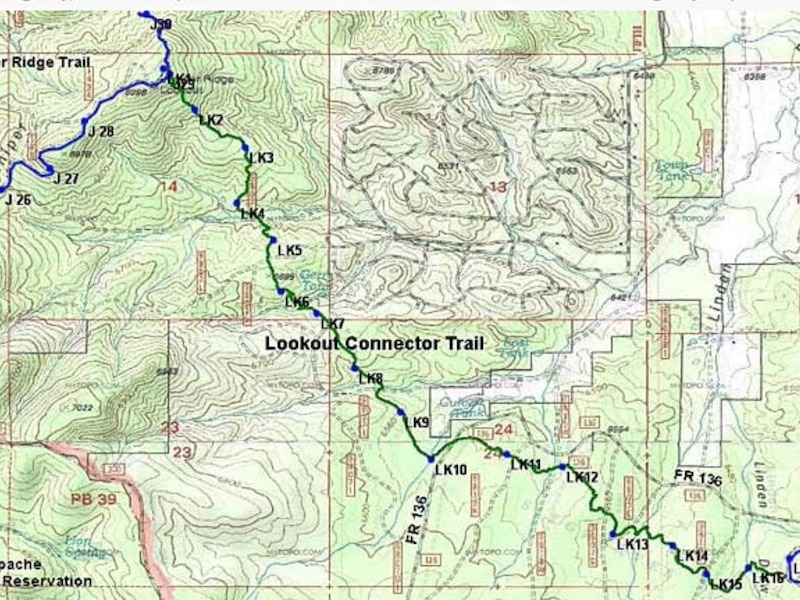
Lookout Connector #640A
The Juniper Ridge Lookout tower is the highest point on the connector at 6,998 feet in elevation.
Distance: 4 miles
Rating: Difficult
Hiking - Mountain Biking - Equestrian
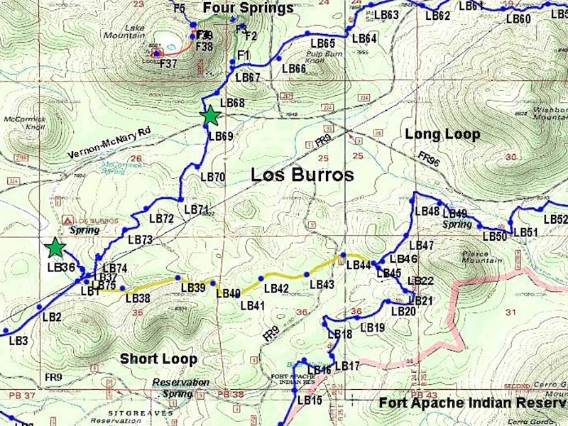
*Los Burros Trail #631
Once the site of the Los Burros Ranger Station. The trail passes through aspen groves and Ponderosa pine.
Distance: 7.75, 9.75, & 13 mile loops
Rating: Moderate
Hiking - *Mountain Biking - Equestrian
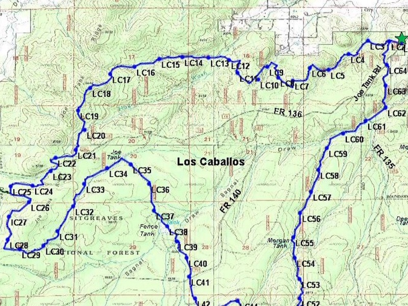
Los Caballos #638
Follows old logging roads as it winds along Joe Tank Ridge and through Bagnal Draw. Includes a number of steep grades.
Distance: 15.5 miles
Rating: Difficult
Hiking - Mountain Biking - Equestrian
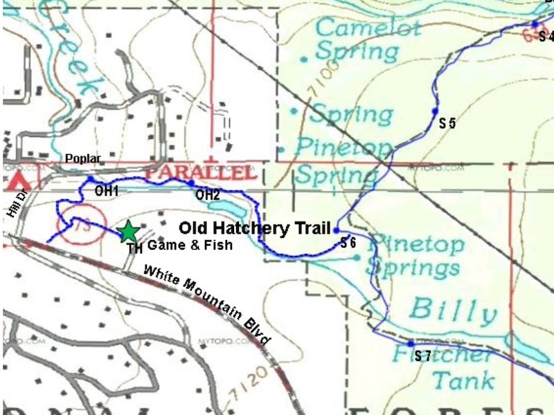
Old Hatchery Trail
Passes old fish hatchery. There is a bridge crossing Billy Creek, before the trail sharply ascends. Partially - hikers only.
Distance: .8 miles
Rating: Moderate
Hiking
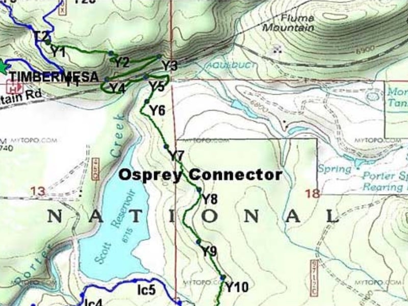
Osprey Connector #636C
The Osprey Connector connects to the White Mountains Trail System from the Timber Mesa Trail. Caution at water crossings.
Distance: 2.5 miles
Rating: Moderate
Hiking - Mountain Biking - Equestrian
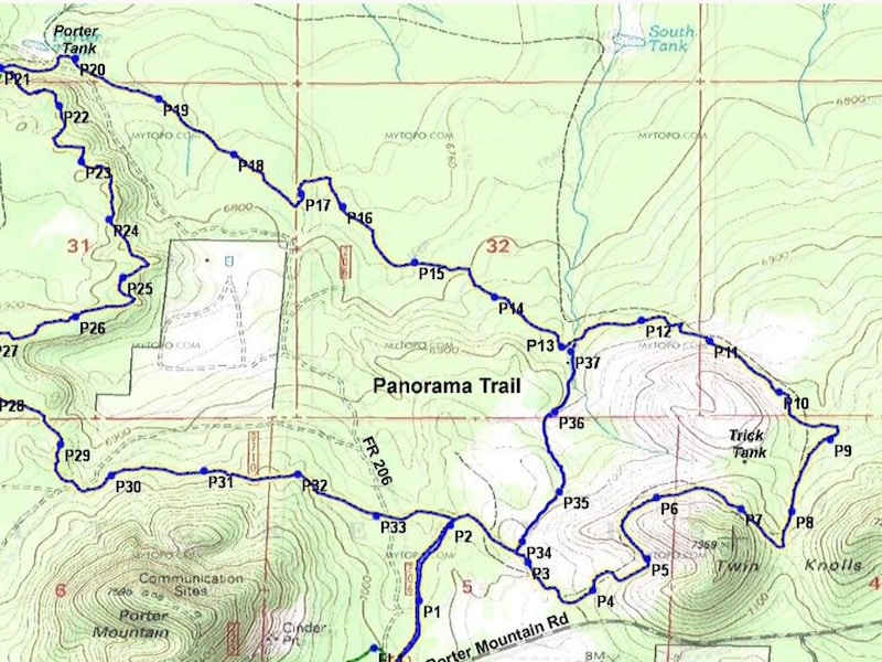
*Panorama Trail #635
Views from Twin Knolls extend to the San Francisco Peaks.Trail passes through a portion of Woolhouse Wildlife Habitat area.
Distance: 9.5 miles
Rating: Moderate
Hiking - Mountain Biking - Equestrian
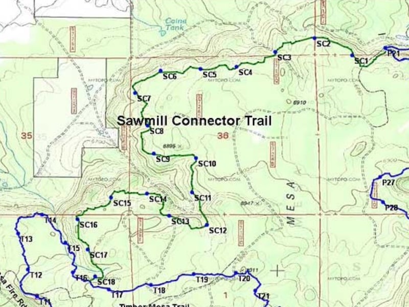
*Sawmill Connector #636A
Rerouted along the ridge north of the old Sawmill forest road trail through scenic areas with lovely views.
Distance: 4.7 miles
Rating: Moderate
Hiking - Mountain Biking - Equestrian
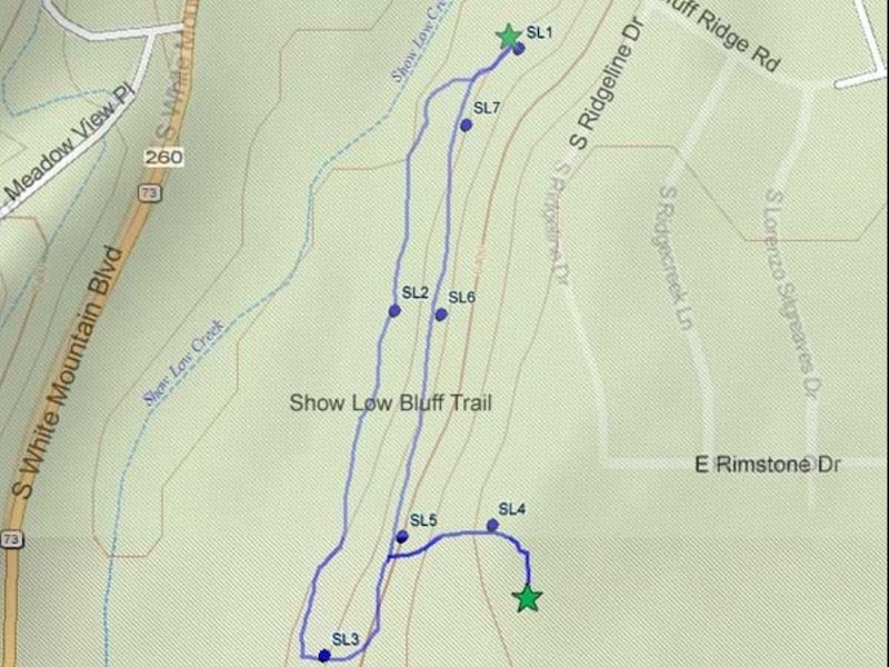
Show Low Bluff Trail
Most of the trail is in the pines, with nice views of Show Low meadow and Show Low Creek.
Distance: 1.5 miles
Rating: Easy
Hiking - Mountain Biking
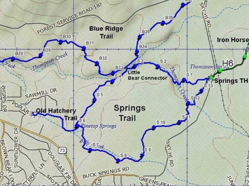
Springs Trail #633
Along the Billy Creek and Thompson Creek riparian areas. Trail can be extremely muddy during the spring and monsoon seasons.
Distance: 3.6 miles
Rating: Easy to Moderate
Hiking - Mountain Biking - Equestrian
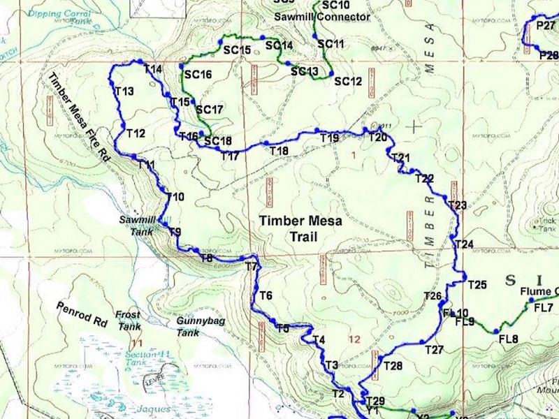
Timber Mesa Trail #636
This trail has been rerouted into scenic areas. Is now about 2 miles longer than the old Timer Mesa Trail.
Explore this trail now through the writing and lens of author and photographer Jonathan Austen.
Distance: 7.5 miles
Rating: Moderate to Difficult
Hiking - Mountain Biking - Equestrian
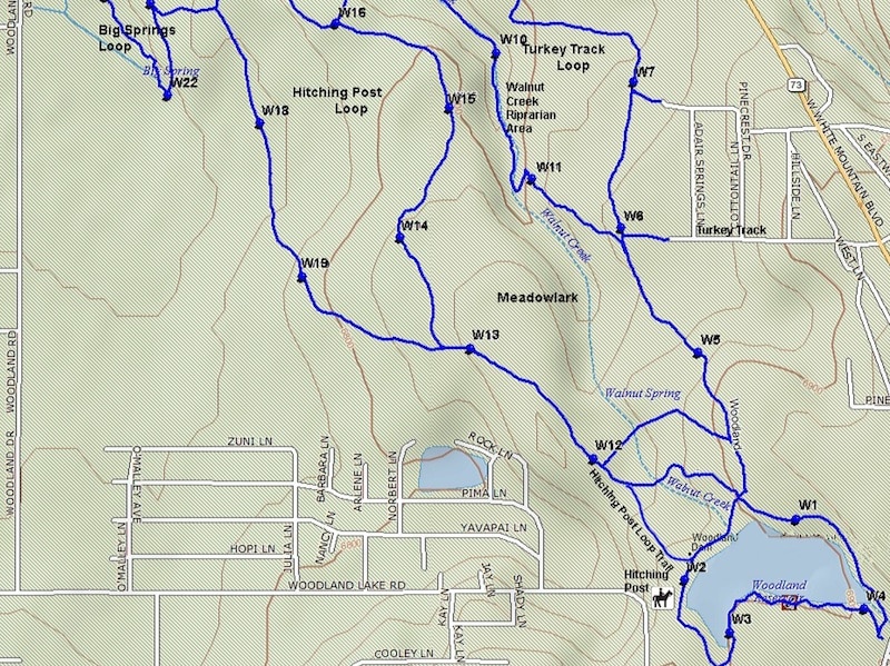
Woodland Lake Park
Trails offer something for almost everyone. A paved ADA-designed trail, ideal for strollers, wheelchairs, etc. winds around the lake.
Distance: 3 miles
Rating: Easy
Hiking - Mountain Biking - Equestrian
Don't Miss a Beat!
MountainSide News™ delivers featured articles via email.
It's FREE
Updates on seasonal events, adventures, places to go,
and things to see and do!
Sign up below!

