Arizona’s Best Hiking
Trails In And Around The Arizona White Mountains
Discover Arizona’s best hiking within the scenic trails of the Arizona White Mountains.
Follow the streams and rivers, ascend a mountain slope, traverse the many flower laden valleys. The Arizona White Mountains have them all!
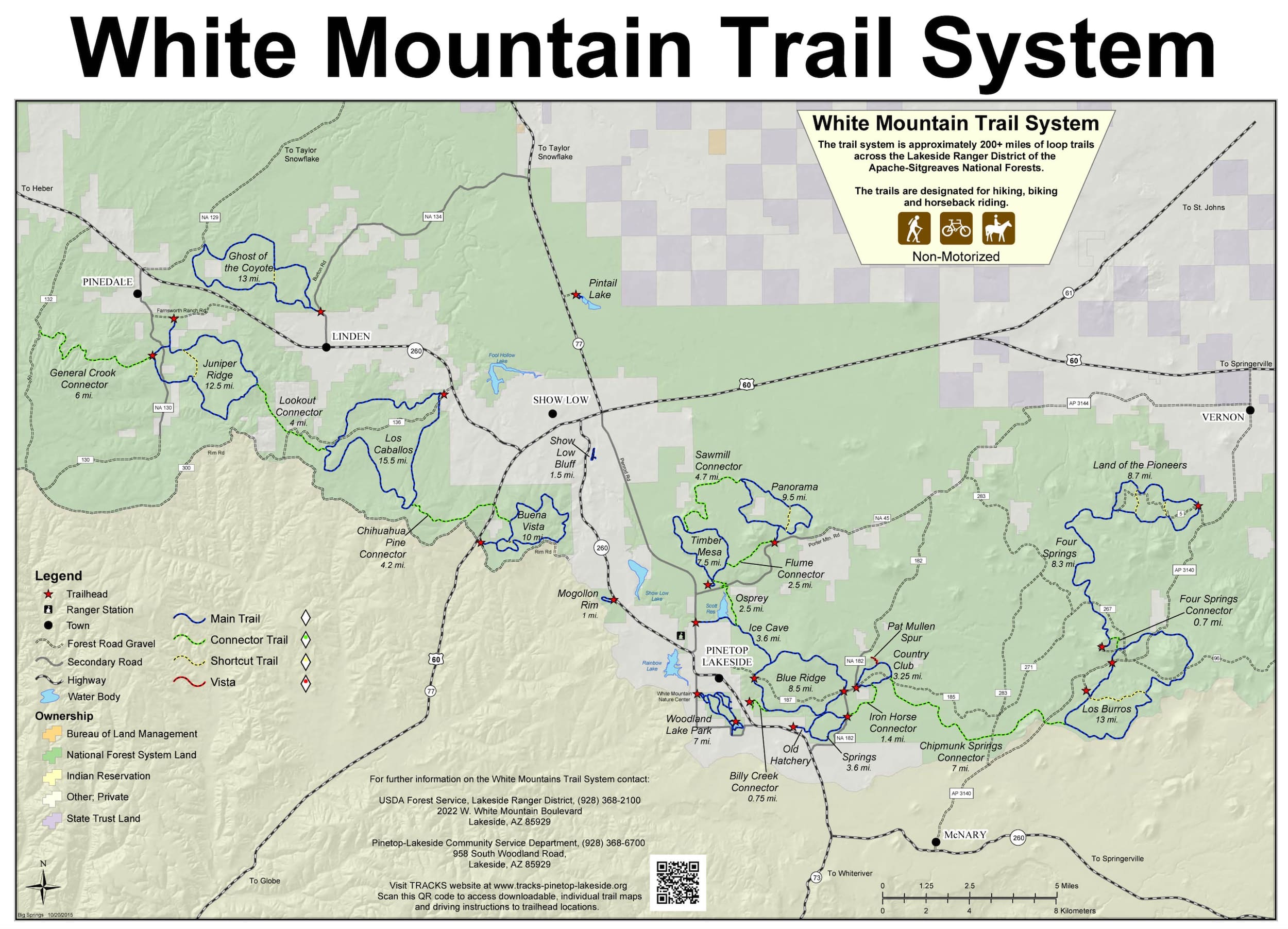
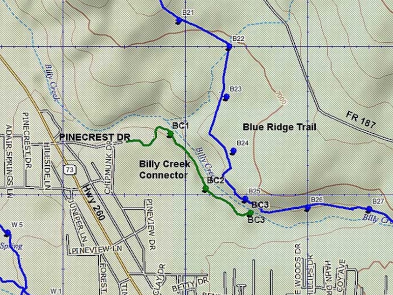
Billy Creek Connector #107A
The trail winds along Billy Creek for about a quarter of a mile and connects with the Blue Ridge Trail at its Southeast corner.
Distance: 0.75 miles
Rating: Easy
Hiking - Mountain Biking - Equestrian
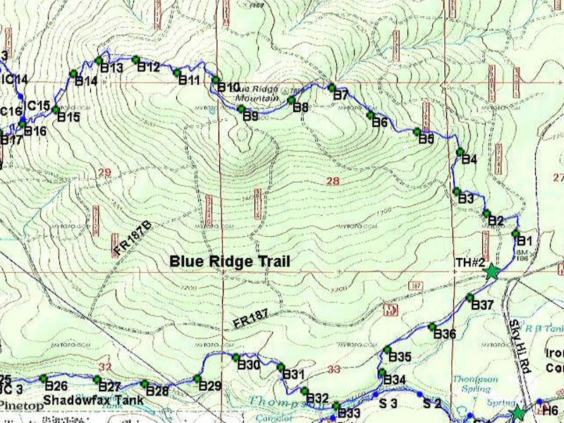
Blue Ridge Trail #107
Follows Billy Creek through a Ponderosa pine forest to the top of Blue Ridge Mountain, with scenic vistas.
Distance: 9.4 miles
Rating: Moderate to Difficult
Hiking - Mountain Biking - Equestrian
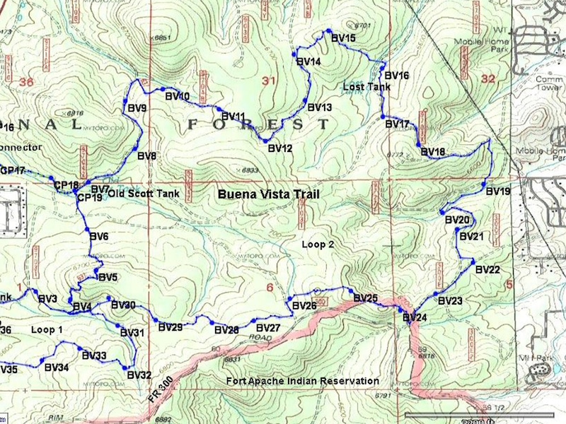
Buena Vista Trail #637
Follows portions of old logging roads through oak, Manzanita, and pine. Impressive views are available on a clear day.
Distance: 10 mile loop
Rating: Moderate to Difficult
Hiking - Mountain Biking - Equestrian
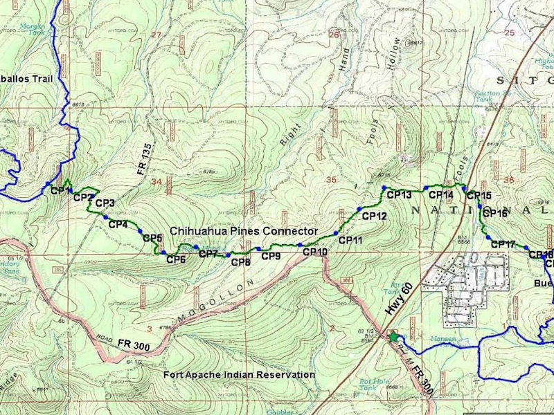
Chihuahua Pine Connector #638A
Many short, steep climbs. The rocky terrain makes mountain biking technical. The trail is named for the Chihuahua pine.
Distance: 4.2 miles
Rating: Difficult
Hiking - Mountain Biking - Equestrian
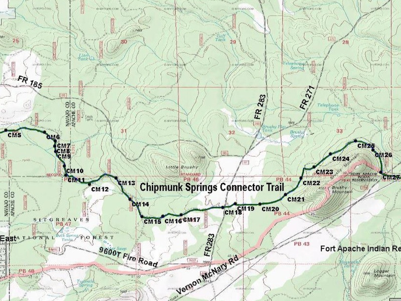
Chipmunk Connector #631A
See Download below for details and directions
Distance: 7.5 miles
Rating: Moderate
Hiking - Mountain Biking - Equestrian
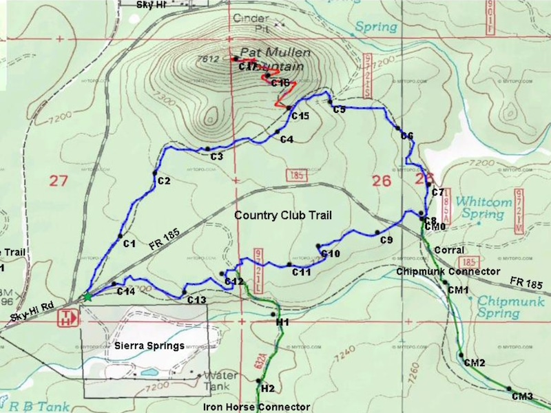
Country Club Trail #632
Loops through a Ponderosa Pine forest along Whitcomb Springs Meadow. It follows portions of the old railroad bed.
Distance: 3.25
Rating: Easy to Moderate
Hiking - Mountain Biking - Equestrian
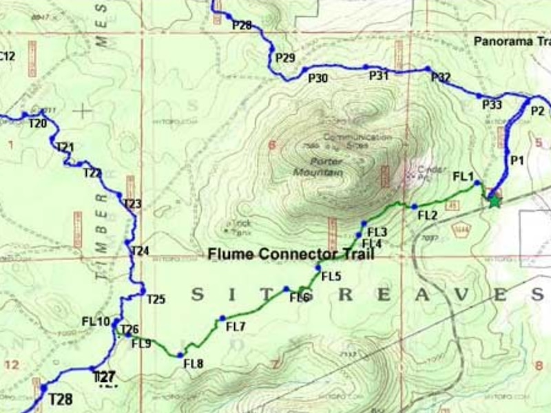
Flume Connector #636B
Named for the flume which carries irrigation water. Visible on the south side of FR 45, just east of the Timber Mesa Trailhead turnoff.
Distance: 2.5 miles
Rating: Moderate
Hiking - Mountain Biking - Equestrian
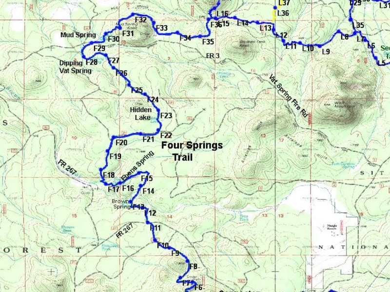
Four Springs Trail #652
The trail winds between four springs and Hidden Lake. Site of a historic sheep camp. Portions of this trail are extremely steep.
Distance: 8.3 miles
Rating: Difficult
Hiking - Mountain Biking - Equestrian
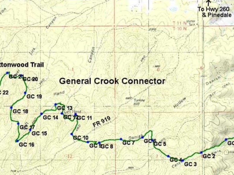
General Crook Connector #104A
Hike through some of the area burned out by the Rodeo–Chediski Fire of 2002, providing fabulous views and prolific wild flowers.
Distance: 6 miles
Rating: Moderate to Difficult
Hiking - Mountain Biking - Equestrian
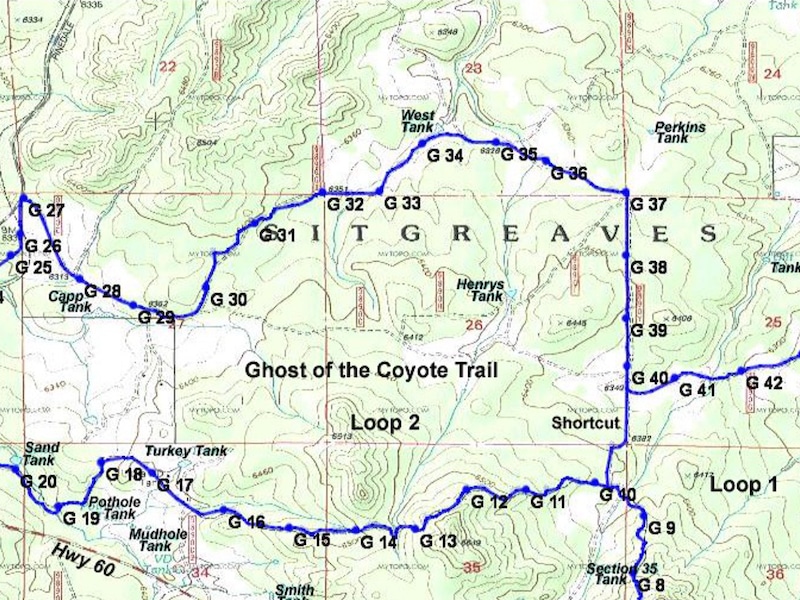
Ghost Of The Coyote #641
Old logging roads through pinion juniper forest. Vistas offer panoramic views of the White Mountains, including Mount Baldy.
Distance: 13 miles
Rating: Difficult
Hiking - Mountain Biking - Equestrian
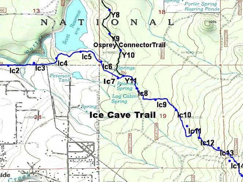
Ice Cave Trail #608
Midway along the trail is the “Ice Cave”, a lava tube. Named for the constant flow of cool air leaving the cave.
Distance: 3.6 miles
Rating: Moderate to Difficult
Hiking - Mountain Biking - Equestrian
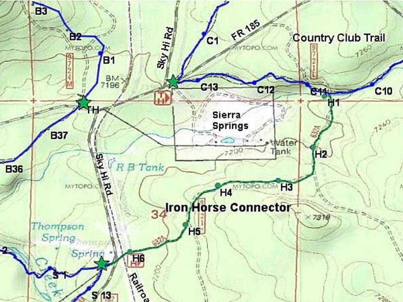
Iron Horse Connector #632A
Trail is fairly flat but somewhat rocky. The trail crosses the abandoned Apache railroad bed.
Distance: 1.4 miles
Rating: Easy
Hiking - Mountain Biking - Equestrian
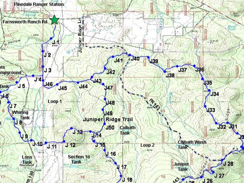
Juniper Ridge Trail #640
Trail goes past the Lookout Tower and some of the burned area. Interesting views of ecological changes caused by the fire.
Distance: 12.44 miles
Rating: Moderate to Difficult
Hiking - Mountain Biking - Equestrian
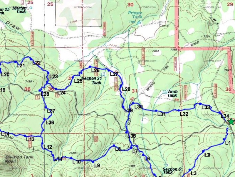
*Land Of The Pioneers #651
Box canyon and ruins of a pioneer cabin onto in the North leg of the loop are must sees. Includes two shortcut loop rails.
Distance: 3.5, 6.8, & 8.7 mile loops
Rating: Moderate to Difficult
Hiking - Mountain Biking - Equestrian
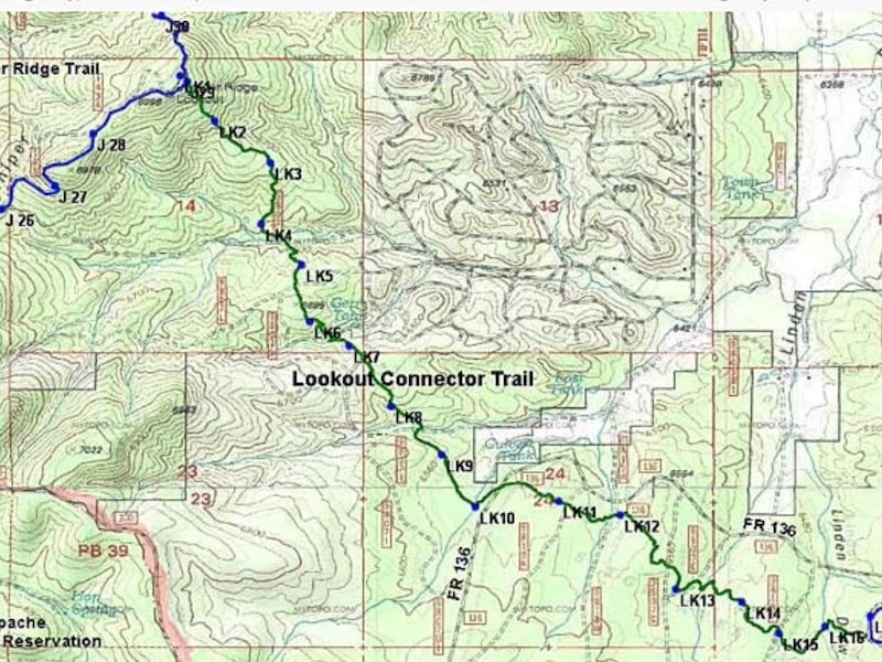
Lookout Connector #640A
The Juniper Ridge Lookout tower is the highest point on the connector at 6,998 feet in elevation.
Distance: 4 miles
Rating: Difficult
Hiking - Mountain Biking - Equestrian
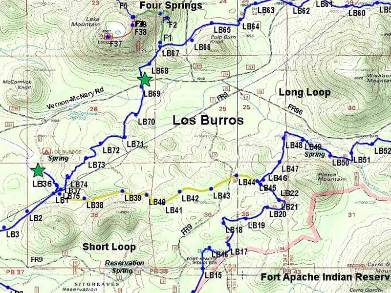
*Los Burros Trail #631
Once the site of the Los Burros Ranger Station. The trail passes through aspen groves and Ponderosa pine.
Distance: 7.75, 9.75, & 13 mile loops
Rating: Moderate
Hiking - *Mountain Biking - Equestrian
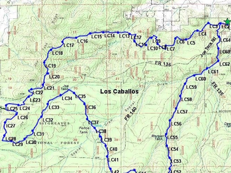
Los Caballos #638
Follows old logging roads as it winds along Joe Tank Ridge and through Bagnal Draw. Includes a number of steep grades.
Distance: 15.5 miles
Rating: Difficult
Hiking - Mountain Biking - Equestrian
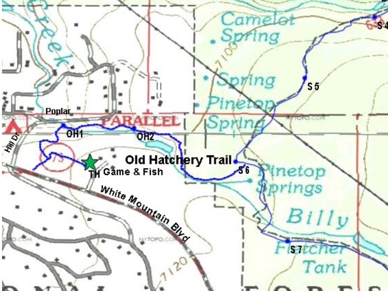
Old Hatchery Trail
Passes old fish hatchery. There is a bridge crossing Billy Creek, before the trail sharply ascends. Partially – hikers only.
Distance: .8 miles
Rating: Moderate
Hiking
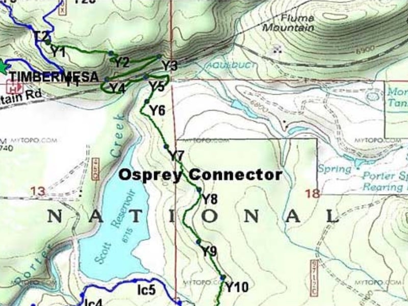
Osprey Connector #636C
The Osprey Connector connects to the White Mountains Trail System from the Timber Mesa Trail. Caution at water crossings.
Distance: 2.5 miles
Rating: Moderate
Hiking - Mountain Biking - Equestrian
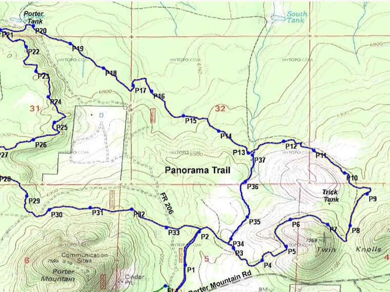
*Panorama Trail #635
Views from Twin Knolls extend to the San Francisco Peaks.Trail passes through a portion of Woolhouse Wildlife Habitat area.
Distance: 9.5 miles
Rating: Moderate
Hiking - Mountain Biking - Equestrian
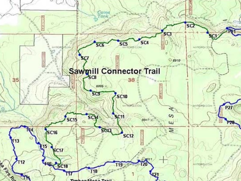
*Sawmill Connector #636A
Rerouted along the ridge north of the old Sawmill forest road trail through scenic areas with lovely views.
Distance: 4.7 miles
Rating: Moderate
Hiking - Mountain Biking - Equestrian
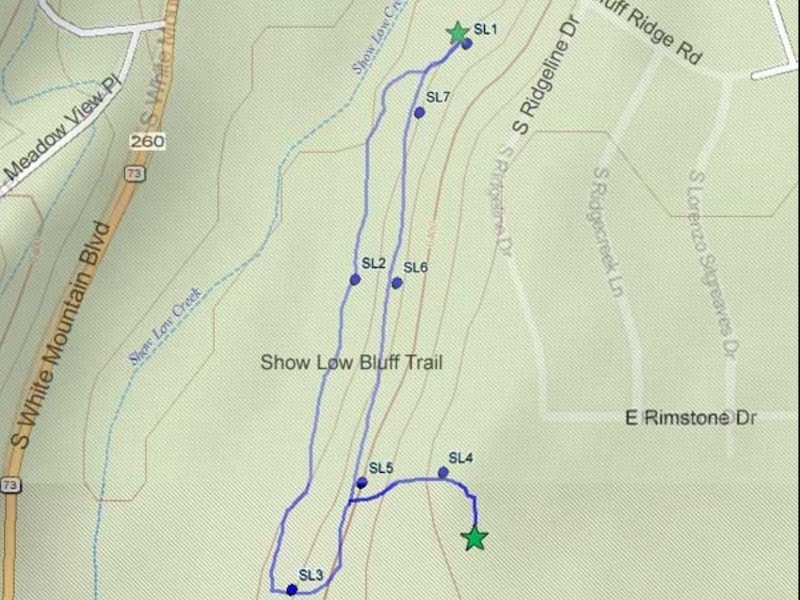
Show Low Bluff Trail
Most of the trail is in the pines, with nice views of Show Low meadow and Show Low Creek.
Distance: 1.5 miles
Rating: Easy
Hiking - Mountain Biking
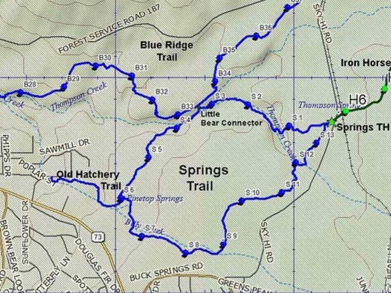
Springs Trail #633
Along the Billy Creek and Thompson Creek riparian areas. Trail can be extremely muddy during the spring and monsoon seasons.
Distance: 3.6 miles
Rating: Easy to Moderate
Hiking - Mountain Biking - Equestrian
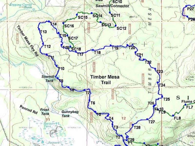
Timber Mesa Trail #636
This trail has been rerouted into scenic areas. Is now about 2 miles longer than the old Timer Mesa Trail.
Distance: 7.5 miles
Rating: Moderate to Difficult
Hiking - Mountain Biking - Equestrian
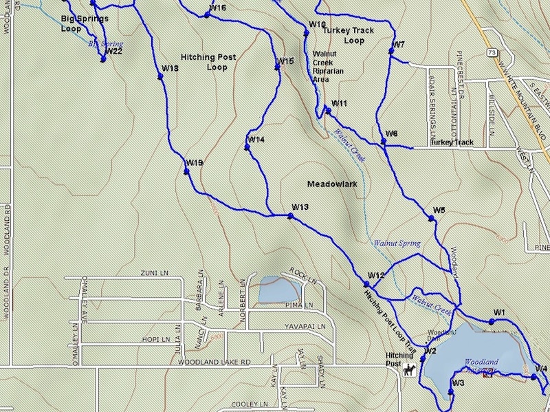
Woodland Lake Park
Trails offer something for almost everyone. A paved ADA–designed trail, ideal for strollers, wheelchairs, etc. winds around the lake.
Distance: 3 miles
Rating: Easy
Hiking - Mountain Biking - Equestrian
Don’t Miss a Beat!
MountainSide News™ delivers featured articles
every month via email.
It’s FREE
PLUS, updates on local seasonal events, places to go,
and things to see and do!
Sign up below!
